Semangkok
Spatial distributions of canopy gaps
In 1994 and 2011 we took a canopy gap censes in a 6-ha plot of hill dipterocarp forest on Semangkok Forest Reserve, Peninsular Malaysia. The plot is gridded into 2,400 5 x 5 m subplots. A canopy gap was defined as subplot where canopy height was lower than 10 m. The observed percentages of the subplots in “gap” class were 15.6% in 1994 and 14.2% in 2011. The overall tree mortality rate between 1993 and 2011 was 1.75% yr-1, and showed no clear variations among DBH class. Because no severe disturbance occurred within the plot, the most subplots showed no change canopy condition (gap or closed canopy) over the inter-census interval. Spatial pattern of canopy gaps were changed in 2011: some gaps around ridge crest decreased their areas, while some lower slope and hollow head parts showed expansion of canopy gap areas.
| Category | 1994 | Relative % | 2011 | Relative % |
|---|---|---|---|---|
| Closed | 2,025 | 84.4 | 2,059 | 85.8 |
| Canopy gap | 375 | 15.6 | 341 | 14.2 |
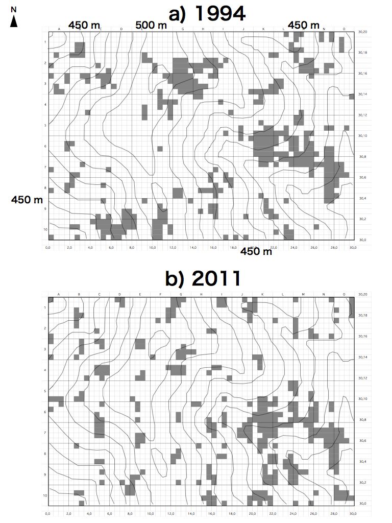
Spatial pattern of canopy gaps in (a) 1994 and (b) 2011 in the 6-ha plot. Subplot under canopy gap shows grey colors. Contour interval is 10m.
References- Sato T et al. (2012) Kanto Journal of Forest Research 63: 89-92 (in Japanese with English summary)