
Home > International Partnerships > Collaborative Research > Spatial Distribution of Households Vulnerable to Deforestation
Update:November 6, 2020
Main content starts here.
Spatial Distribution of Households Vulnerable to Deforestation
1. Partners
Forestry Administration, Cambodia
2. Research Period
FY 2016–2017 Grant-in-Aid for Scientific Research (KAKENHI)
3. Lead Researcher
EHARA, Makoto (Center for International Partnerships and Research on Climate Change)
4. Background
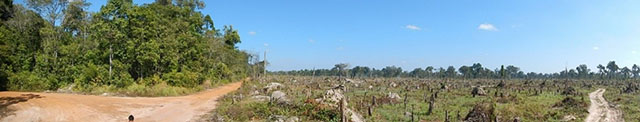
The livelihood of rural residents in Cambodia is often dependent on forests as it provides non-timber forest products (NTFPs). Such forests, however, are rapidly diminishing because of developments in agribusiness, subsistence agriculture, and timber extraction. Some of those affected by these developments either relocate their collection sites or convert distant forests to other land uses to compensate for their income loss. These coping strategies can create conflicts in NTFP collections and affect the livelihoods of the residents of other forests. This creates a vicious cycle of further conflict and forest loss. To address this problem, immediate policy interventions and measures are required to relieve the affected stakeholders and to prevent further consequences on NTFP collections from deforestation.
5. Research Goal
The study estimates the spatial distribution of villages with households vulnerable to impacts of deforestation in NTFP collections in the eastern part of the Kompong Thom province, Cambodia. Holistic forest management informed by this information will address the vicious cycle of deforestation in the province by taking the number and geographical distribution of the vulnerable households into account.
6. Research Strategy
(1)The DPSIR framework* was used to systematically understand the vicious cycle of deforestation and to consider forest management measures that take the needs of vulnerable residents into consideration. To address the deforestation pressures, including their coping strategies, and mitigate the impacts on local people, we conducted literature review and field observations. We identified concrete policies and measures for the each component of DPSIR framework: 1) cautious allocation of economic land concessions (ELCs); 2) justification of forest programs’ substantial economic and social benefits’ delivery; 3) recruiting forest-dependent residents as community forestry guards; and 4) identifying marketable NTFPs and improving the management of commercial NTFPs.
*The DPSIR framework is one of the tools for describing the relationship between ecosystems and the people who use their benefits in environmental policy and research. The framework consists of five components: Driver (D) is the root cause of environmental problems in human society; Pressure (P) created by the Driver directly causes the problems; State (S) is the state of social and ecology that changes under the pressure; Impact (I) is resulted by the changed state; Response (R) is the societal measure or response to address PSI. The five strategic goals of the Aichi Biodiversity Targets, agreed at the 10th Conference of the Parties to the Convention on Biological Diversity, are also in line with the components of the DPSIR Framework.
(2)By overlaying the forest maps of 2014 and 2016 we delineated the deforestation of the surveyed site. We conducted a questionnaire survey on sampled households, considering the village distribution and forest management classification in the sampling. The characteristics of villages where the residents were affected by deforestation and selective cutting of trees providing NTFPs were analyzed using the generalized linear mixed model (GLMM). Focusing on the collection of resins, a typical NTFP collection in the region, we developed two models of resins and other NTFP collections. Then, the model allowed us to predict the probability of village in which an affected population will reside.
7. Scientific Achievement
We revealed the spatial distribution of villages with households vulnerable to impacts of deforestation that took place from 2014–2016 in the eastern part of the Kompong Thom province, Cambodia. We estimated the spatial distribution of the villages based on the identified characteristics of the deforestation-affected residents. Villages close to Prey Long Wildlife Sanctuary with a high proportion of households that collect resins as a major livelihood activity had higher probability of being affected by deforestation and selective cutting of trees. For NTFP collections other than resins, these characteristics are a large area of deforestation per capita within a 10 km radius of the village, and a high proportion of households who collected NTFP for cash income.
8. Applications
The Cambodian government and NGOs need to address coping strategies of villagers who are vulnerable to deforestation in terms of NTFP collections because they create conflicts in NTFP collections and cause further unplanned deforestation. Our results allow the identification of specific locations where immediate policy interventions and measures are needed. The applied method can also be used for the development of selection criteria for areas that require immediate relief and/or preventive measures outside the survey area.
9. Publications
Makoto Ehara, Kimihiko Hyakumura, Ren'ya Sato, Kiyoshi Kurosawa, Kunio Araya, Heng Sokh, Ryo Kohsaka. 2018. Addressing Maladaptive Coping Strategies of Local Communities to Changes in Ecosystem Service Provisions Using the DPSIR Framework., Ecological Economics 149, 226-238., DOI:10.1016/j.ecolecon.2018.03.008
Copyright © Forest Research and Management Organization. All rights reserved.